DATA CENTRE
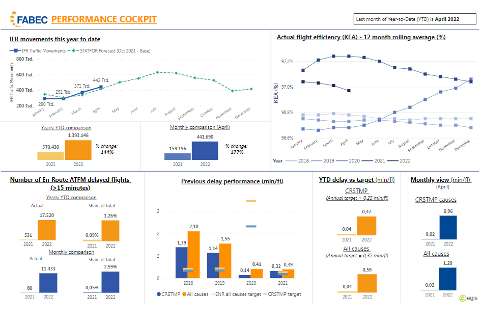
Our Data Cockpit gives you easy access to many different types of data from the ATC world. Year-to-date and monthly views of movement figures, delay performance and flight efficiency are frequently updated and allow you to compare developments and evaluate traffic, delay and environmental patterns. We will continue to expand the topics included over time.
ENABLING AVIATION
Innovation is key for a dynamic industry such as aviation.
Thus, the interactive map gives an overview of ongoing or planned projects contributing to the FABEC performances targets. It lists local or multilateral projects of the FABEC partners deemed relevant to the FABEC achievement.
MEDIA RELEASES
16 DEC 2024FABEC States and ANSPs invite Airspace User Associations for workshop on Performance Indicators
More info04 DEC 2024The FABEC leadership takes note of the successful cooperation for the delivery of the SES and the joint performance plan for the years 2025-2029
More info04 SEP 2024FABEC NSAs consult stakeholders on draft RP4 Joint Performance Plan in Luxembourg
More info02 JUL 2024FABEC is preparing for increased traffic demand in the core area
More info- More Media Releases
NEWS ARCHIVE
19 APR 2024WORKSHOP Predictability and Flexibility in ATM
read more01 JUL 2024Tackling challenges together
read more02 JUL 2024FABEC is preparing for increased traffic demand in the core area
read more04 SEP 2024FABEC NSAs consult stakeholders on draft RP4 Joint Performance Plan
read more- View the full News archive

The airspace of the six FABEC States of Belgium, France, Germany, Luxembourg, the Netherlands and Switzerland is one of the busiest and most complex in the world.
The majority of major European airports, major civil airways and military training areas are located in this area. FABEC airspace covers 1.7 million km


